經緯度
Coordinates
|
262132N 1202859E |
地理位置
Location
|
東引島南端
at south end of Dongyin island
|
標高
Elevation
|
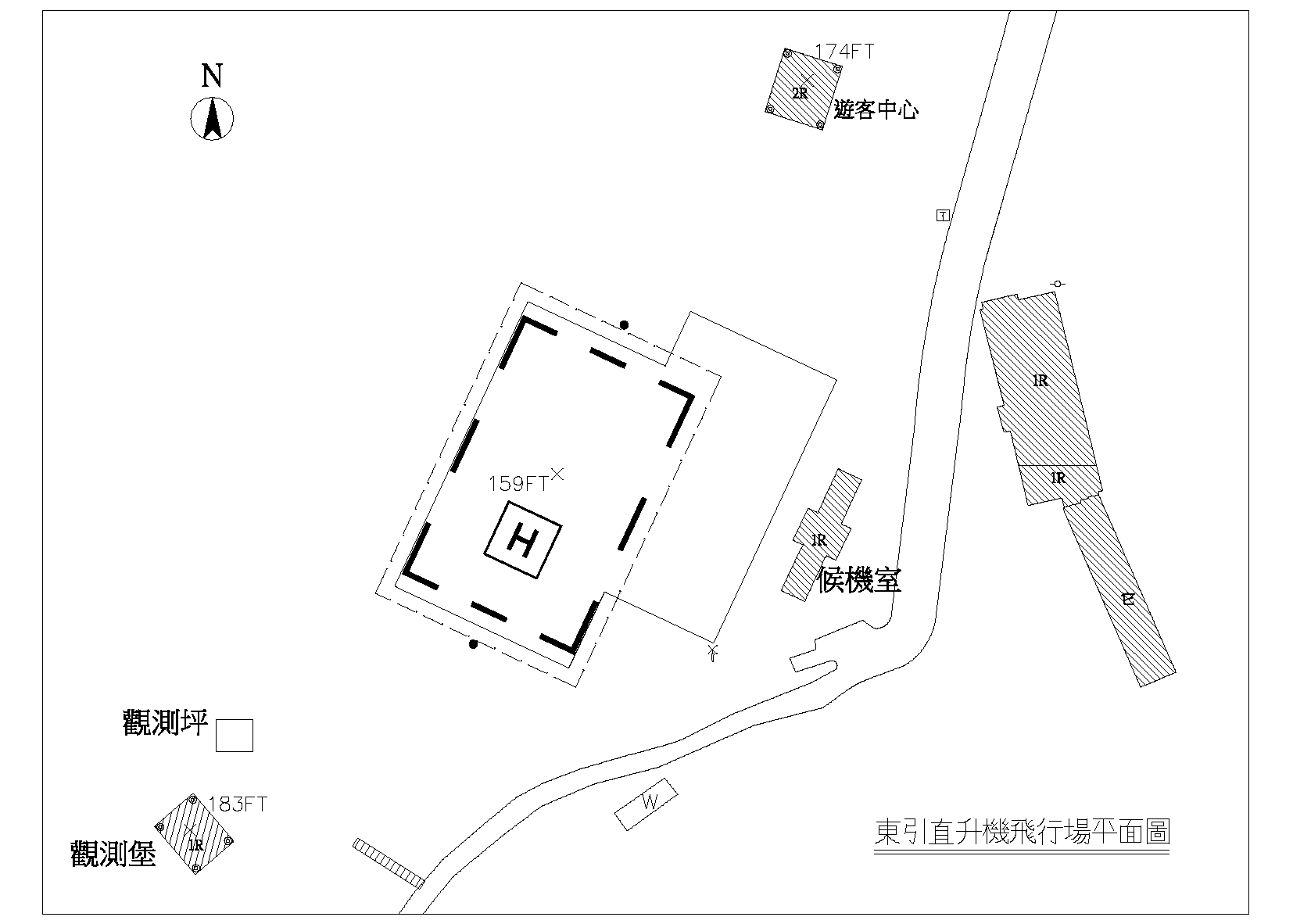
159FT |
作業時間
Operation Hours
|
日出至日沒
HJ
|
型式
Type
|
平面
Surface level
|
降落區
Alighting Area
|
長方形
rectangle
59.3M x 40M
|
最大起降機型
Allowable for ACFT type up to
|
Bell 412 |
燈光設施
Lighting
|
最後進離場區燈 x12
起降區周邊燈 x12
直昇機機場標燈 x1
起降區照明 x1
風向指示器 x1
下滑道三色導引儀 x2
FATO Light x12
TLOF Perimeter Light x12
Heliport Beacon x1
TLOF floodlight x1
Wind Direction Indicator x1
Glide Path Indicator x2
|
管理單位
Administration
|
連江縣政府
電話:0836-76331-2
傳真:0836-76334
地址:連江縣東引鄉東引西段地號 1289 號
Lienchiang County Government
TEL: 0836-76331-2
FAX: 0836-76334
ADS: No. 1289, (West Dongyin), Dongyin Township, Lienchiang County, Taiwan, R.O.C.
|
用途
Purpose
|
直昇機運輸業務
Transportation
|
備註
Remark
|
-
觀光署遊客中心位於本飛行場東北面,軍方設施位於本飛行場西南面。
-
北側直昇機進場滑降指示燈距最後進離場區邊緣 6M,高度 0.9M;南側直昇機進場滑降指示燈距最後進離場區邊緣 6M,高度 1M。
-
A Tourist Service Center is on the northeast of this heliport, and a military facility is on the southwest of this heliport.
-
The Helicopter Approach Path indicator on the north is 0.9M high, and the distance from FATO edge is 6M. The Helicopter Approach Path indicator on the south is 1M high, and the distance from FATO edge is 6M.
|